
Most property owners are often uncertain about the accuracy of their property lines and boundary maps. You may wonder if a free coordinates finder can help validate this information. This post will explore how these tools work, their reliability, and what you should consider when verifying property lines, empowering you to make informed decisions about your land. By leveraging accessible technology, you can gain a clearer understanding of your property boundaries.
The Mechanics of Property Lines and Boundary Maps
Understanding the mechanics behind property lines and boundary maps is imperative for accurate land ownership validation. These elements are often established through surveyors who utilize a combination of physical markers on the ground and digital data, ensuring that each plot’s dimensions and limits are clearly defined. Geographic Information Systems (GIS) technology plays a significant role in visualizing and analyzing these boundaries, providing detailed maps that reflect legal ownership and zoning classifications.
Defining Key Terms: Property Lines and Boundary Maps
Property lines refer to the defined legal boundaries of a piece of land, dictating ownership and usage rights. Boundary maps, on the other hand, provide a visual representation of these lines, illustrating spatial relationships and adjacent properties. Accurate identification of both is vital for landowners seeking to understand the extent of their rights and responsibilities.
Common Challenges in Property Line Identification
You may encounter several challenges when identifying property lines, including outdated or inaccurate boundary maps, discrepancies between physical markers and documented limits, and ambiguous historical records. Local regulations and neighboring fence lines can also create confusion, leading to potential disputes over property ownership.
Inaccurate boundary maps are one of the leading challenges, as many were created years ago and may not reflect current developments or changes in land use. Additionally, natural features like trees or streams may shift over time, impacting visual references for property lines. Neighboring property disputes often arise due to misinterpretation of these documents, emphasizing the necessity for accurate surveys. Seeking a professional surveyor’s assistance can mitigate these issues, ensuring clear boundary identification and reducing legal complications. Lastly, local zoning regulations may complicate your understanding, impacting the perceived usage of your property, which may differ from legal definitions. Understanding these layers is imperative for effective property management.
The Role of Coordinates in Boundary Verification
Coordinates serve as the foundational reference points that define property boundaries. They provide an exact geographical framework for identifying the limits of your land, ensuring that you can accurately assert ownership and navigate potential disputes. By using precise latitude and longitude data, along with other geographical information, you can verify whether existing boundary maps align with the actual coordinates of your property.
How Coordinates Determine Property Boundaries
Coordinates pinpoint the exact geographic location of property lines, directly impacting how boundaries are established and respected. When property deeds and maps utilize specific coordinates, they form a legal and physical basis for delineating property borders. This allows you to track your property’s boundaries accurately against public records and potential encroachments.
Tools and Technologies for Coordinate Accuracy
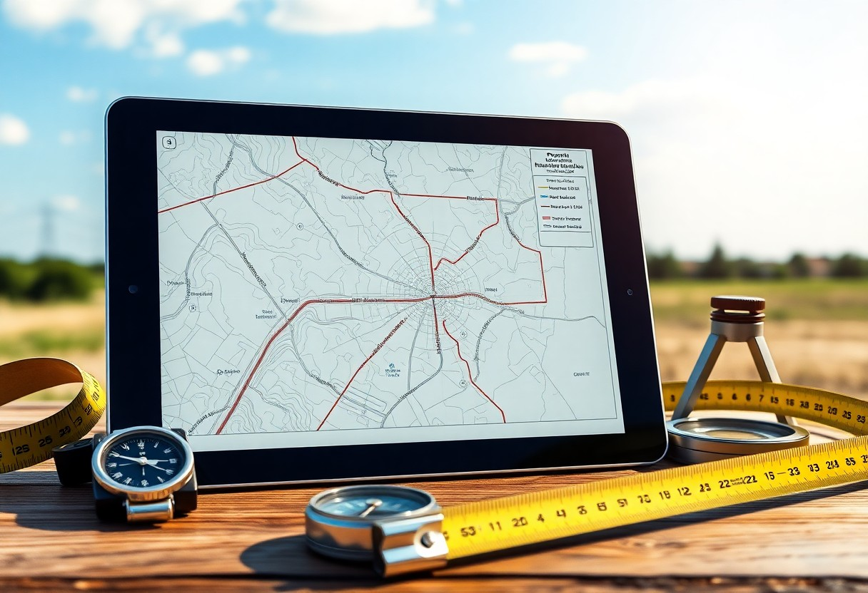
Numerous tools and technologies enhance the accuracy of property coordinates, from GPS devices to advanced surveying equipment. These innovations enable precise measurements, facilitating better boundary verification. Modern smartphones also offer coordinate-finding applications that can help check your property lines with ease, ensuring you have the most accurate data at your fingertips.
Tools like Geographic Information Systems (GIS) have revolutionized boundary verification by offering detailed mapping capabilities. These systems can overlay property boundaries with accurate satellite imagery, allowing you to see real-time data about your plot. Drones equipped with high-resolution cameras can capture aerial images, ensuring that your coordinates correlate accurately with ground realities. Surveying equipment such as Total Stations can provide millimeter-level precision, making it easier for you to confirm boundaries against official documents. All these tools combined provide a comprehensive approach to verifying your property lines effectively.
Evaluating Free Coordinates Finder Tools
Choosing the right free coordinates finder tool requires careful consideration of features, accuracy, and ease of use. Many platforms offer basic functionalities, but they can differ significantly in the level of detail and precision provided. Evaluating them based on user reviews, data sources, and compatibility with your needs helps ensure that you get a reliable result.
Comparing Popular Free Tools for Coordinates Extraction
| Tool Name | Key Features |
| Google Maps | Satellite imagery, street view, API access |
| OpenStreetMap | User-generated data, customizable maps |
| GPS Coordinates Finder | Simple interface, multiple location formats |
Limitations and Considerations When Using Free Tools
While free tools can be convenient, they may come with limitations that impact their effectiveness. Many platforms rely on user-generated data which can lead to inaccuracies or outdated information. Additionally, free tools often lack advanced features such as precise measurements or legal boundary delineation, making them less reliable for critical property line evaluations.
For instance, Google Maps may provide a comprehensive view of land features, but it might not offer exact property lines since those are often subject to local regulations and surveys. Consequently, while they can serve as a starting point, relying solely on these tools for legally binding decisions brings inherent risks. Always corroborate findings with official documentation or expert opinions to ensure accuracy and compliance with property laws.
Legal Implications of Misidentifying Property Lines
Misidentifying property lines can lead to significant legal repercussions, impacting your ownership rights and financial stability. Errors in boundary determination may result in encroachments, requiring costly disputes or even litigation to resolve. Courts often rely on official surveys and local laws to determine property boundaries, so inaccuracies can undermine your claims and lead to penalties or loss of property rights.
The Risks of Boundary Disputes
Boundary disputes frequently arise when property lines are unclear or misrepresented. Such conflicts can escalate quickly, leading to strained neighborly relationships and prolonged legal battles. You may find yourself facing increased legal fees, and possible damages as courts attempt to settle disagreements over encroachments or mislaid markers.
Understanding Local Regulations and Surveying Requirements
Your local regulatory environment dictates the protocols governing property surveys and boundary determinations. Familiarizing yourself with these regulations is necessary, as they vary significantly by location. Particular attention should be paid to zoning laws, which can influence property line definitions and other restrictions on land use.
Each locality may have specific surveying requirements that property owners must adhere to, such as obtaining a licensed surveyor’s report for boundary verification. Some jurisdictions mandate that property lines are explicitly marked and documented. Failing to comply with these requirements could yield penalties, leaving you vulnerable to disputes grounded in misinterpretation of your property’s actual boundaries. Always check with local authorities or consult a real estate attorney to ensure adherence to applicable laws and regulations, thereby safeguarding your property interests.
Practical Steps for Verifying Property Lines
Begin by accessing your county’s property records, often available through the local assessor’s office or online databases. Cross-reference these records with any boundary maps you possess. Utilizing a tape measure, you can also physically mark points based on the coordinates of your property lines. This method allows you to visualize the actual boundaries and compare them against the maps at hand. If discrepancies arise, keep thorough documentation to support your findings.
Utilizing Free Resources Effectively
Online platforms like Google Earth or property viewer tools can reveal satellite imagery and detailed maps of your area. These resources provide a broad view of property lines, helping you cross-check against official documents. Additionally, forums and community websites often share local knowledge, offering insights into boundary history that may not be documented. Engaging with these resources allows you to gather a well-rounded perspective on your property’s delineation.
When to Seek Professional Help for Boundary Verification
Consider consulting a licensed surveyor if you’re facing persistent disputes regarding your property lines or have uncovered conflicting information. Surveyors possess specialized training and advanced tools that can yield precise measurements and legally recognized boundaries. Complex property layouts or historical claims often necessitate their expertise. Solutions they offer include staking your property lines, which provides a visual reference that can mitigate misunderstandings with neighbors.
Conclusion
Considering all points, you can verify property lines and boundary maps by using a free coordinates finder, although the accuracy may vary. This tool enables you to cross-reference coordinates with official documents, helping you clarify any ambiguities regarding your property boundaries. However, for legal assurance or disputes, consulting a professional surveyor is recommended to ensure your findings are precise and reliable.