
Lines that define your property in Hillsborough County are necessary for understanding your land rights and responsibilities. Knowing the exact boundaries of your property can help you avoid disputes with neighbors, increase your land value, and ensure proper land use. In this blog post, you will learn how to identify these lines, locate your property description, and understand what resources are available to you within Hillsborough County. Armed with this information, you’ll be better prepared to make informed decisions regarding your property.
Many homeowners in Hillsborough County seek clarity on property lines to ensure they understand their property boundaries. Knowing where your property begins and ends is necessary for various reasons, including property taxes, zoning regulations, and potential disputes with neighbors. This post will guide you through the process of determining your property lines, the resources available to you, and the importance of accurate information for any home improvement or construction plans.
The Legal Framework Defining Property Boundaries
Understanding the legal framework that defines property boundaries is crucial for any homeowner in Hillsborough County. Your land rights hinge on how property lines are established and recognized by law. This framework is embedded in state laws, local ordinances, and case law that clarify not just where your property starts and ends but also the rights you have concerning that land.
Understanding Property Law in Hillsborough County
Property law in Hillsborough County is governed by Florida statutes and local regulations that outline how property boundaries are defined. You must familiarize yourself with these laws to navigate issues related to easements, encroachments, and zoning. Often, the original land surveys play a pivotal role in solidifying your understanding of property boundaries.
Key Regulations Governing Boundary Determination
Several regulations underpin property boundary determination in Hillsborough County. The Florida Statutes, particularly Chapter 177, detail the processes for surveying and mapping land. These regulations ensure that all property lines are accurately surveyed, recorded, and publicly accessible, allowing you to verify your boundaries and protect your rights effectively.
Key regulations, including the requirements outlined in the Florida Statutes, serve as the foundation for boundary determination. For instance, professional surveyors must adhere to specific standards when establishing property lines, ensuring accuracy and accountability. Additionally, local ordinances may stipulate how boundaries are publicly recorded, making it easier for you to access crucial information. Utilizing this data can help prevent disputes and guarantee that you are fully aware of your property limits. Further, case law often clarifies interpretations of these laws, providing a more comprehensive understanding of your legal standing in any boundary disputes.
Deciphering the Legal Framework of Property Lines
Understanding property lines in Hillsborough County involves navigating a complex legal landscape. Property rights are largely governed by a combination of state statutes, local ordinances, and zoning laws that dictate what you can and cannot do with your land. Each parcel is defined by deeds, easements, and established boundaries, which can sometimes lead to disputes if not clearly understood. Knowing where to look for this legal information can save you from potential misunderstandings regarding your property boundaries.
Understanding Local Ordinances and Zoning Laws
Your property is subject to specific local ordinances and zoning laws in Hillsborough County that establish how land can be used. These regulations can dictate everything from the type of structures allowed on your property to the types of activities permissible within your zone. For instance, if you plan to build a fence or an accessory structure, understanding these rules is key to avoiding fines or forced removal later. Always check with your local zoning department to ensure your plans align with these regulations.
The Role of Land Surveys in Establishing Boundaries
Land surveys play an imperative role in accurately delineating property lines. These professional assessments utilize precise measurements and markers to identify the corners of your plot, often revealing historical boundaries that may not be evident to the naked eye. A well-executed survey can clarify boundaries for you, helping avoid disputes with neighbors and providing a solid foundation for any future development or changes to your property. Engaging a licensed surveyor is an effective way to ensure you have a reliable and legally sound understanding of your property lines.
Specifically, surveys are conducted using a variety of techniques and tools, ranging from traditional methods involving compasses and measuring tapes to advanced technologies like GPS and aerial imagery. A reputable surveyor will deliver a detailed report that includes a map of your land, which can be useful for documenting property lines to avoid encroachment disputes. Additionally, if you’re considering buying or selling property, a current survey may be necessary to confirm boundaries are clearly defined and understood by all parties involved. Having a recent survey on hand can protect your interests and enhance your property’s value in potential dealings.
Mapping the Landscape: How Property Lines Are Established
Property lines are not arbitrary; they stem from a combination of historical records, surveys, and legal descriptions. When establishing property lines, surveyors draw upon a range of sources, including deeds, title reports, and historical maps. These references help ensure accuracy and provide context, allowing you to understand how boundaries have evolved over time. As urban development increases, so does the need for precise demarcations to avoid disputes and misunderstandings regarding land ownership.
Surveying Techniques and Their Importance
Surveying techniques play a pivotal role in the establishment of property lines, employing methods such as triangulation, GPS technology, and traditional measurements. By calculating angles and distances, surveyors can develop highly accurate land boundaries. Precision is vital; even a small error can lead to significant disputes over property ownership. Utilizing established practices ensures that your property’s boundaries are clearly defined, minimizing future conflicts with neighbors.
The Role of GIS Technology in Property Line Mapping
Geographic Information Systems (GIS) technology has transformed how property lines are mapped and visualized. By integrating spatial data with mapping software, GIS provides you with detailed geographic information that aids in accurately defining property boundaries. This technology considerably enhances the efficiency of property line assessments, allowing stakeholders to benefit from data analysis, pattern recognition, and even predictive modeling.
GIS technology offers a wealth of information and tools for more effective property line mapping. With features like layering, real-time updates, and spatial analysis, GIS enables you to visualize how your property relates to surrounding land parcels. Consider, for example, a landowner wanting to research zoning regulations and environmental features; GIS can provide insights in seconds, highlighting critical factors that influence property line definition. Ultimately, embracing GIS can streamline not only the mapping process but also your decision-making when it comes to issues of property demarcation and development.
The Impact of Property Lines on Homeownership
Your property lines significantly influence your homeownership experience, affecting everything from landscaping to future renovations. Knowledge of your boundaries ensures you respect your neighbors’ space and adhere to local regulations. Misunderstandings about property lines can lead to costly disputes, affecting your peace of mind and property enjoyment.
Encroachments and Disputes: Common Scenarios
Encroachments often arise from fences, trees, or even buildings extending slightly beyond designated property lines. This can lead to disputes with neighbors, especially if one party feels their property rights are being violated. Homeowners may need to address these issues amicably or involve mediation to clarify boundaries and resolve conflicts.
How Boundaries Influence Property Value
Your property’s boundaries play a pivotal role in determining its value. Clear, well-defined property lines often enhance marketability, ensuring potential buyers see the full extent of what they’re purchasing. Well-maintained yards and landscaping that respects these lines can further increase desirability.
For instance, homes with established boundaries that include features like fencing or landscaping can command higher prices than those without clear demarcation. In neighborhoods where space is at a premium, encroachment disputes can deter buyers, leading to lower offers or prolonged listings. As a homeowner, understanding the impact of property lines can guide you in enhancing your property’s market value and appeal.
Navigating Disputes: Common Challenges and Resolutions
Disputes over property lines can escalate quickly, leading to tension among neighbors and complicating property ownership. Common challenges involve unclear boundaries, encroachments, and conflicting surveys. Resolving these issues often requires clear communication and, if necessary, professional help to clarify boundaries and rights. Taking proactive measures can help you navigate these disputes efficiently before they escalate.
Types of Property Line Disputes
Property line disputes can often manifest in various forms, including:
- Encroachments (e.g., fences or structures extending onto neighboring land)
- Disagreement over boundary markers
- Conflicting survey results
- Access issues (e.g., shared driveways)
- Adverse possession claims
After identifying your specific issue, you can pursue appropriate resolutions.
| Type of Dispute | Description |
|---|---|
| Encroachment | One neighbor builds on another’s property without consent. |
| Boundary Markers | Disagreements arise over the placement of boundary signs or fences. |
| Conflicting Surveys | Different assessments may lead to disputes over true property lines. |
| Access Issues | Complications can arise over shared access roads or pathways. |
| Adverse Possession | Possession of land that may lead to claims of ownership over time. |
Mediation and Legal Remedies Available
When property line disputes arise, various mediation and legal remedies can assist in finding a resolution. Mediation often serves as a first step, allowing neighbors to communicate their concerns and work through solutions with a neutral third party. If mediation fails, you may need to explore options such as filing a partition action, seeking a declaratory judgment, or potentially pursuing adverse possession claims, depending on the specifics of your case.
Mediation typically involves informal discussions and negotiations facilitated by a mediator, allowing both parties to express their views and propose possible solutions. This approach can save time and resources compared to litigation. If necessary, legal remedies can be pursued through the court system for more formal resolution, which can include filing for an injunction to stop encroachments or seeking a court-ordered survey to define actual property lines. Understanding the available options empowers you to address property line disputes effectively while minimizing conflict.
Technological Advances in Boundary Determination
Modern technology has significantly transformed how property lines are identified and defined. Innovations in surveying tools and mapping software streamline the boundary determination process, enhancing accuracy and efficiency. You now have access to advanced methodologies such as GPS technology, which allows for precise location data, and automated systems that reduce human error in measurement calculations, providing a clearer insight into your property’s dimensions.
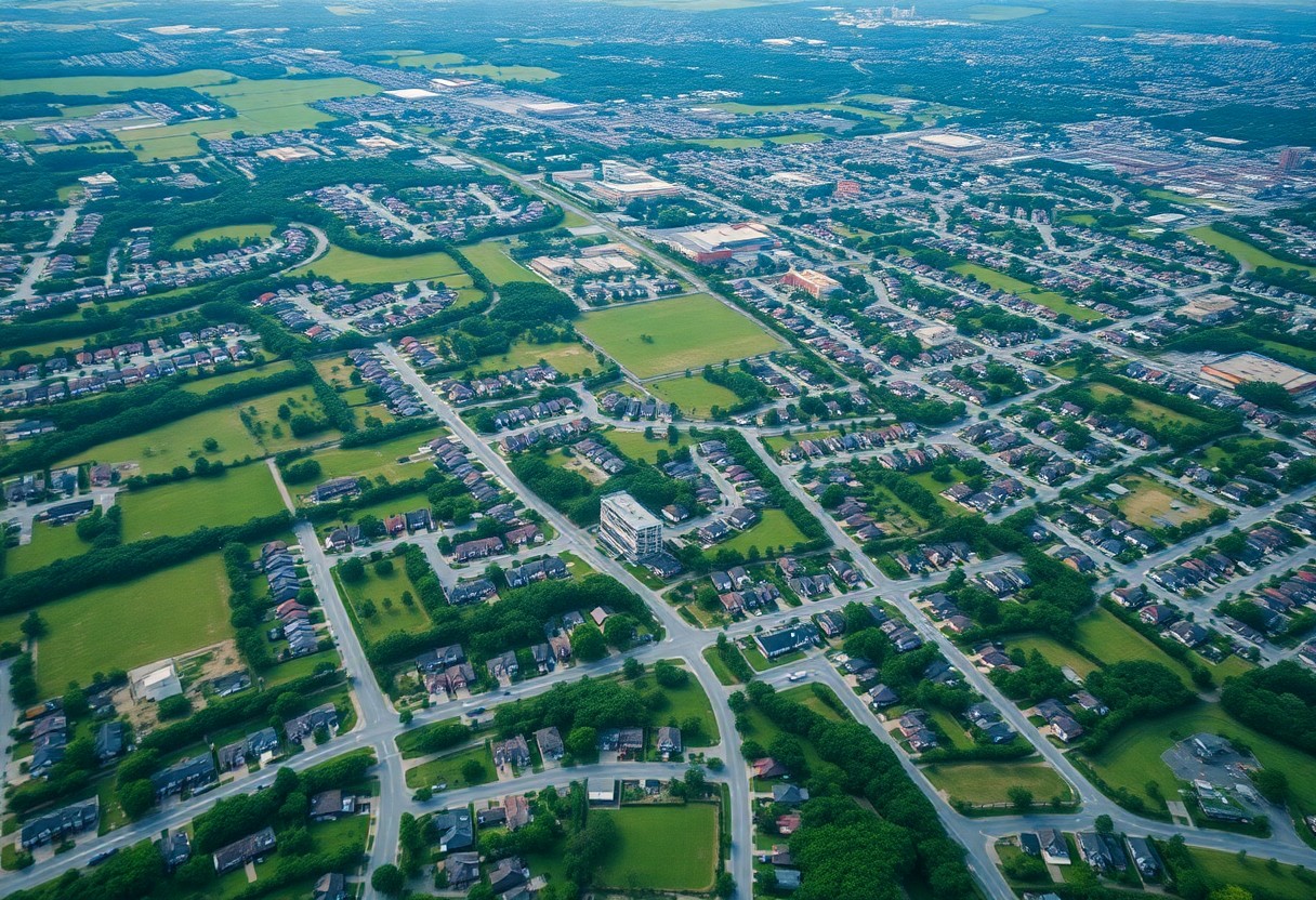
Aerial Imagery and GIS: Revolutionizing Property Mapping
Aerial imagery combined with Geographic Information Systems (GIS) has reshaped the landscape of property mapping. High-resolution satellite images and drone technology allow for real-time visualization and analysis of land parcels. You can utilize these tools to overlay historical and current data, enabling you to assess land use changes and measure property lines with greater precision than ever before.
The Future of Property Line Verification via Technology
Advancements in property line verification will likely continue evolving with the integration of artificial intelligence and machine learning. These technologies can analyze vast amounts of data from various sources, including historical records and environmental factors, to produce more accurate boundary determinations. You may soon find that verification processes become more automated, with software tools that provide instant insights into property disputes, significantly streamlining resolution efforts.
The Impact of Zoning Laws on Property Lines
Zoning laws play a significant role in shaping property lines and land use in Hillsborough County. These regulations dictate how land can be utilized, which in turn influences property values and development potential. Understanding these laws is vital for property owners as they navigate implications for their land, including any restrictions on construction, modifications, or land use that could affect their overall property line perceptions.
How Zoning Restrictions Affect Property Boundaries
Zoning restrictions can directly impact your property boundaries by defining permissible uses and dimensions within specific districts. For instance, if your property resides in a residential zone, it may be subject to height limitations or setbacks that influence the placement of fences, buildings, or other structures. Violating these zoning codes could result in penalties or a requirement to alter your property in accordance with the regulations, which could further complicate established boundaries.
Future Development Considerations and Property Lines
The potential for future development around your property can significantly affect how you perceive and manage your property lines. With the county’s growth and changing development priorities, staying informed about local zoning proposals is vital to understand how they might modify your current boundaries or land usage rights. Knowing the long-term plans for neighboring parcels can preemptively address disputes and better guide your investment decisions.
Future development considerations should always be on your radar, as changes in zoning laws or increased demand for specific land uses can alter not only the character of your neighborhood but also your property boundaries. For instance, if new commercial zones arise nearby, this could lead to increased traffic, noise, and changes in the desirability of your area. Additionally, understanding potential upcoming infrastructure projects, such as roads or public facilities, can provide insight into how property lines might be challenged or redefined. Engaging with local planning boards and city council meetings can help you protect your interests and stay ahead of possible alterations to your property landscape.
Navigating Property Boundary Disputes
Disagreements regarding property boundaries often arise from unclear or inaccurate surveys, leading to frustration. When you find yourself in a dispute, effective communication with your neighbor can sometimes lead to resolution without further escalation. Consider discussing the issue openly while presenting any documentation or surveys you possess, and remain receptive to their perspective. If discussions fail, you might explore mediation, which can provide a neutral ground for both parties to come to an agreement and avoid lengthy legal battles.
Mediation and Legal Remedies: Finding Solutions
Engaging in mediation can be a cost-effective way to resolve boundary disputes with your neighbor. A mediator helps facilitate constructive dialogue, finding common ground that satisfies both parties. If mediation does not yield results, seeking legal remedies, such as a quiet title action, might be necessary to clarify ownership rights. In some cases, the courts may also provide remedies for encroachments if a neighbor has built on your land without permission.
The Importance of Professional Guidance in Complex Cases
For nuanced property disputes, obtaining professional guidance can make a significant difference. Real estate attorneys or licensed surveyors bring valuable expertise and insights into the legal framework and the technical aspects of property lines. Their skills can help you navigate complications arising from easements, historical use, or unclear documentation, which could affect your case outcome.
Involving professionals ensures that all aspects of the boundary dispute are thoroughly examined. For example, an experienced real estate attorney can identify potential legal pitfalls, while a surveyor can provide precise measurements and mapping. Such comprehensive analysis not only enhances your position in negotiations but also equips you with the necessary information for court proceedings, should you need to escalate the issue further.
Resources for Homeowners: Tools and Services for Boundary Clarity
Understanding your property lines in Hillsborough County involves leveraging various resources that provide boundary clarity. Numerous tools and services are available to assist you, ensuring that you have accurate information regarding your land. Utilizing professional expertise and online resources can save you time, money, and potential disputes with neighbors.
Professional Surveyors and Their Expertise
Hiring a licensed professional surveyor guarantees that you obtain precise measurements of your property lines. These experts are well-versed in local zoning laws and regulations, ensuring your property boundaries are accurately indicated on a survey map. Their insights can be invaluable if you’re planning to build, fence, or make improvements on your property.
Online Resources and Public Records for Property Research
Accessing online platforms and local public records can demystify your property lines. Hillsborough County’s Property Appraiser’s website offers interactive maps where you can view aerial imagery and parcel boundaries. Official records can also be obtained from the County Clerk’s office, revealing historical data on land ownership, zoning, or easements that may affect your property.
In addition to official government resources, numerous mapping websites allow you to visualize property boundaries. Using resources like GIS (Geographic Information Systems) tools or sites like Zillow provides additional context and satellite imagery. Online access to the Hillsborough County Clerk’s land records can unveil past transactions, boundary changes, or encroachments, giving you a comprehensive understanding of your property. These tools make it easier for you to determine ownership history and any geographical features that could influence your property lines.
Community Awareness and Neighborly Relations
Understanding property lines fosters healthy community dynamics in Hillsborough County. When residents are well-informed about their boundaries, they can address land use issues more effectively and maintain neighborly relations. Open dialogue encourages respect for personal space while fostering a sense of community. Being proactive in understanding where your property ends and your neighbor’s begins can prevent misunderstandings, promote conflict resolution, and ultimately contribute to a harmonious neighborhood atmosphere.
Building Goodwill: The Role of Open Communication
Open communication serves as a foundation for positive neighborly relations, especially regarding property boundaries. Actively engaging with your neighbors about property lines not only helps clarify any potential issues but also builds trust. Regular conversations about mutual boundaries can lead to agreements that respect each person’s space while creating a cohesive community. Avoiding assumptions and promoting dialogue can prevent disputes and enhance neighborhood cohesion.
Civic Resources for Boundary Education and Assistance
Hillsborough County provides various civic resources to aid residents in understanding property boundaries, including online databases, educational workshops, and local government offices. Leveraging these resources enables you to access accurate property information, such as surveys, zoning regulations, and local ordinances. Utilizing services like the Hillsborough County Property Appraiser’s website can offer crucial insights into property lines, helping you make informed decisions and maintain positive relationships with your neighbors.
In addition to the Property Appraiser’s resources, you can benefit from local workshops hosted by community organizations that provide practical guidance on boundary disputes and property laws. These educational opportunities cover topics like dispute resolution resources, understanding your property’s legal description, and how to engage a professional surveyor if needed. Reaching out to your local neighborhood association may also unveil additional resources and platforms for discussing community layout and addressing any boundary concerns. By actively seeking knowledge, you can safeguard your property rights while fostering relationships within your community.
Summing up
From above, understanding Hillsborough County property lines is necessary for navigating ownership rights and responsibilities. You should be aware of how property lines can impact your plans for construction, landscaping, and disputes with neighbors. Familiarizing yourself with the local regulations and obtaining accurate surveys can greatly assist you in making informed decisions regarding your property. By taking these steps, you can ensure that you respect boundaries while maximizing the potential of your land.
Summing up
From above, understanding Hillsborough County property lines is imperative for any property owner or potential buyer in this region. You need to be aware of how these boundaries affect your rights, responsibilities, and any future development plans. Familiarizing yourself with local zoning laws and survey details serves to protect your investment and ensure you make informed decisions. Whether you’re looking to build, renovate, or simply enjoy your property, knowing the specifics of your property lines can significantly influence your experience and planning in Hillsborough County.