
Just when you thought navigating property lines in North Carolina was complicated, GIS mapping tools come to the rescue. These advanced technologies empower you to visualize and comprehend the boundaries of your property with precision. Whether you’re a homeowner, investor, or real estate professional, understanding how to leverage these tools can provide clarity in property disputes, zoning issues, and more. In this blog post, you will discover how GIS mapping can simplify the intricate web of property lines and enhance your understanding of your land assets.
Mapping Property Boundaries with Precision
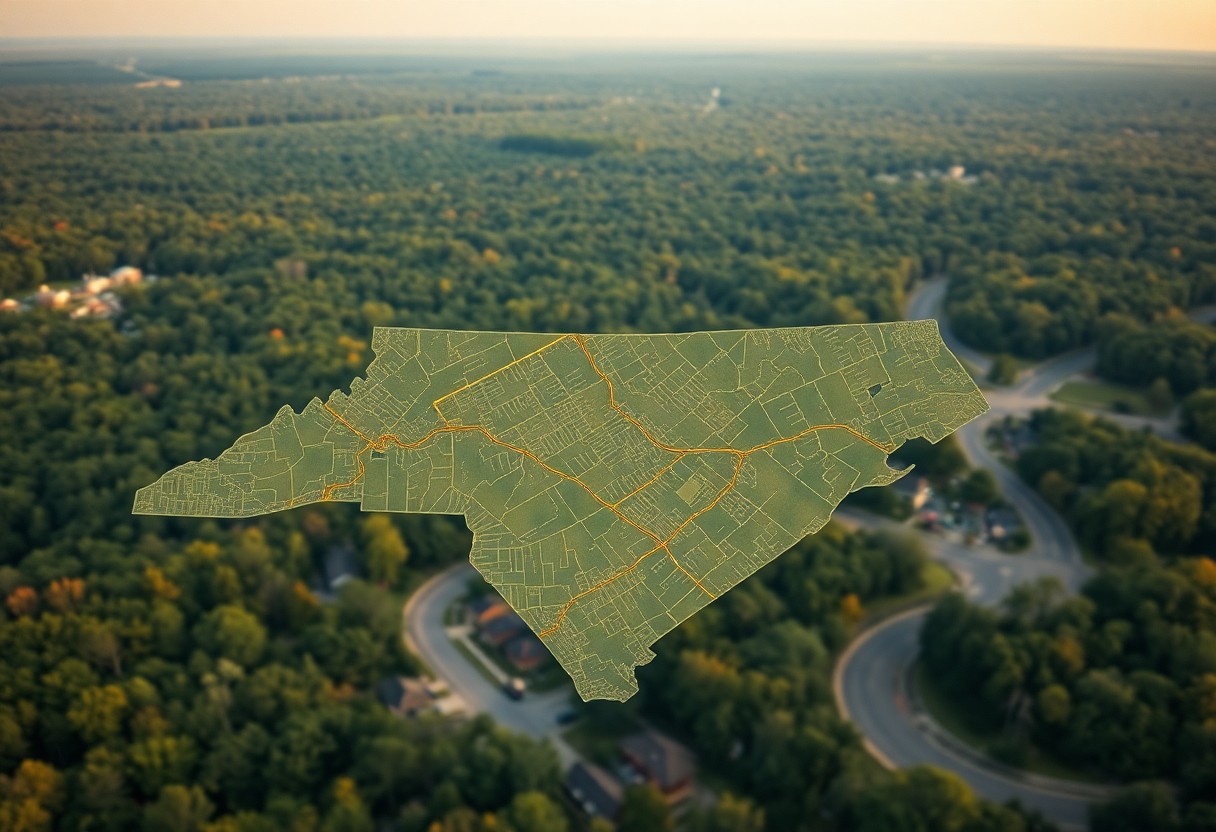
With GIS mapping tools, you can pinpoint property boundaries with remarkable precision, making it easier to visualize your land in a digital format. These tools allow you to overlay various data layers, such as topography, zoning regulations, and previous survey lines, helping you to see exactly where your property starts and ends. By utilizing satellite imagery and high-resolution maps, you can gain a comprehensive understanding of your land, helping you make informed decisions whether you’re buying, selling, or developing property.
The Technology Behind GIS Tools
GIS tools leverage advanced technologies like remote sensing, aerial photography, and spatial data analysis to create highly detailed maps. This technological foundation facilitates the collection and interpretation of geographic information, allowing you to access layered data tailored to your property. Integrating various sources enhances the reliability of the data and gives you the ability to visualize complex relationships between different geographic elements.
Accuracy in Survey Data and Cartography
GIS technology significantly elevates the accuracy of survey data and cartography, vital for any property-related endeavor. The integration of precise coordinates, boundary markers, and historical data ensures that your mapped property aligns perfectly with actual land features. Additionally, GIS tools utilize algorithms and statistical methods to refine this data, resulting in maps that minimize errors and provide you with dependable information.
Incorporating GPS data further enhances accuracy, enabling you to measure property boundaries down to the centimeter. For instance, modern surveying techniques can achieve an accuracy of +/- 1 centimeter, which is a game changer when it comes to defining property lines. This level of precision reduces disputes, making your ownership clearer and more defensible against encroachments and misunderstandings with neighbors. Ultimately, armed with accurate GIS maps, you hold a powerful asset for navigating property ownership confidently in North Carolina.
Navigating Local Regulations and Property Laws
Navigating the maze of local regulations and property laws can feel overwhelming. GIS mapping tools simplify this process by visualizing legal boundaries and zoning regulations effectively. With clear representations of property lines, you can easily identify restrictions, easements, and zoning designations in your area, ensuring that your property use aligns with local ordinances.
Understanding North Carolina’s Land Use Policies
North Carolina’s land use policies are diverse and can vary significantly by county and municipality. Familiarizing yourself with these regulations allows you to avoid potential pitfalls that could arise from non-compliance. GIS tools provide you with dynamic maps that overlay various land use categories, helping you visualize how your property fits into the broader landscape of local regulations.
Accessing Public Land Records Through GIS
You can access public land records seamlessly through GIS mapping tools, which aggregate various datasets related to property. This access equips you with imperative information such as ownership history, tax assessments, and any prior surveys. The ability to view these records geographically enhances your understanding of any encumbrances and historical changes on your property, aiding in informed decision-making.
Exploring public land records via GIS allows you to navigate complex property information effortlessly. Many counties in North Carolina host online GIS portals where you can visually inspect property details. For example, Mecklenburg County offers a comprehensive GIS mapping system that includes public access to zoning maps, flood zones, and historical ownership data. Engaging with these records fosters transparency and ensures you are equipped with vital information during transactions or potential disputes.
Enhancing Property Dispute Resolution
GIS mapping tools play a significant role in resolving property disputes by providing comprehensive visual data that clarifies ownership and boundary lines. By offering clear, high-resolution maps that are easy to interpret, these tools create transparency, allowing all parties to grasp the specifics of the disputed area. This clarity can facilitate negotiations or mediation processes, minimizing conflicts and promoting amicable solutions between neighbors or disputing parties.
Visualizing Ownership and Boundary Lines
Utilizing GIS technology allows you to visualize property lines and ownership through detailed digital mapping. These maps can highlight land parcels, showing exact boundaries, easements, and adjacent property lines. As a result, you can quickly ascertain where your property ends and another begins, making it easier to address any discrepancies or misunderstandings without guesswork.
The Role of GIS in Mediation and Legal Processes
Concerning mediation and legal procedures, GIS mapping emphasizes clarity in property-related disputes. Incorporating GIS data can support claims and arguments, presenting visual evidence to resolve misunderstandings or misrepresentation of property lines. This mapping can save time and resources in legal contexts, as it allows for quick reference to factual information that holds weight in discussions or court proceedings.
For instance, in a mediation setting, both parties can access layered GIS data that represents historical property line changes, zoning regulations, and environmental factors. Legal professionals increasingly use these digital maps to build their cases, helping judges and juries visualize the dispute’s context. Empirical data from GIS tools can substantiate claims and streamline legal processes, often leading to quicker resolutions without the need for lengthy court battles.
Integrating Local Knowledge for Better Decision-Making
Understanding the nuances of property boundaries often requires local insights. By integrating community knowledge with GIS mapping tools, you can enhance your decision-making process. Local residents might have historical context about property lines that official documents do not reflect. Combining this qualitative information with quantitative GIS data can reveal patterns or issues that may not be immediately apparent, leading to more informed choices regarding property management or development.
Collaborating with Property Stakeholders
Engaging with property stakeholders—such as neighbors, local authorities, and real estate professionals—can aid in clarifying boundaries and resolving disputes. Open dialogue fosters an environment where insights and experiences are shared, helping you understand historical uses of land. This collaboration can lead to accurate interpretations of property lines and foster community relationships, which are invaluable when facing decisions about property development or alterations.
Utilizing Community Resources and GIS Platforms
Community resources and GIS platforms serve as vital tools to comprehend local property dynamics. Look for local government websites that offer GIS capabilities to view parcels and zoning maps. Additionally, online platforms that host community discussions can facilitate knowledge sharing about property issues and local regulations. By leveraging these resources, you can enhance your understanding of property lines while also fostering stronger community connections.
GIS platforms, such as county-specific applications or state-wide mapping services, not only provide detailed visualizations of property lines but also often include vital information about land use, zoning restrictions, and community plans. Some platforms allow users to contribute local insights, enabling residents to annotate maps with personal histories or anecdotal evidence related to property boundaries. This fusion of modern technology with grassroots knowledge empowers you to approach your property-related decisions with a comprehensive understanding of the landscape you’re working within.
Future Trends: Innovations in GIS and Property Mapping
The future of GIS and property mapping in North Carolina is bright, with continuous enhancements in technology promising improved user experiences. Advances such as 3D mapping and virtual reality interfaces will enable you to visualize property lines and terrain in a more immersive manner. Furthermore, the integration of artificial intelligence and machine learning is expected to streamline data analysis, providing quicker insights into property ownership trends and zoning regulations. These innovations not only make GIS tools more accessible but also increase their accuracy, helping you make informed decisions about land use.
Emerging Technologies Reshaping Property Insights
Emerging technologies like augmented reality (AR) and blockchain are revolutionizing the way you engage with GIS tools. AR enables you to overlay property data onto the real world using your smartphone or tablet, offering a dynamic way to explore property boundaries and features. Blockchain, on the other hand, can enhance the transparency and security of property transactions, simplifying title searches and ensuring the provenance of property records is verifiable and tamper-proof.
Potential Impact on Real Estate and Development
The impact of these technologies on real estate and development is substantial, as they streamline operations and enhance decision-making. You can expect faster processing times, improved accuracy in land surveys, and more effective project management through predictive analytics. Additionally, developers and investors will find it easier to assess property values and potential risks, potentially leading to more sustainable and profitable development projects in North Carolina’s evolving landscape.
For developers, utilizing advanced GIS mapping tools can mean the difference between success and setbacks. With the ability to visualize multiple factors—such as land use patterns, demographic data, and environmental considerations—you can more effectively identify promising investment opportunities. Moreover, accurate data allows for better assessments of community impact, ensuring you align projects with local needs and regulations. As these technologies become standard, the competitive edge gained through informed, data-driven decision-making will be vital in the fast-paced real estate landscape of North Carolina.
Summing up
Now, you can utilize GIS mapping tools to gain a clearer understanding of property lines in North Carolina. These tools allow you to visualize property boundaries, assess land usage, and identify nearby landmarks or features that may affect your property. By accessing detailed maps and spatial data, you can make more informed decisions regarding land ownership, development, and potential disputes. Embracing GIS technology empowers you to navigate the complexities of property lines with ease and confidence.