
Just knowing the exact boundaries of your property can save you time, money, and potential disputes. Whether you’re planning construction, installing a fence, or simply want to understand your land better, this guide from EarthPlat will walk you through reliable methods to accurately locate your property lines in Florida. By following these steps, you’ll gain the confidence to manage your property with clarity and assurance.
Key Takeaways:
- Begin by reviewing your property deed and checking the plat map to understand your property description and layout.
- Utilize tools such as property line apps like EarthPlat and consult recent professional surveys for precise boundary identification.
- Explore local resources like county property appraiser websites and collaborate with neighbors for additional boundary information.
1. Review your property deed for legal boundary descriptions. 2. Check the plat map for subdivision layout details. 3. Use EarthPlat app to easily locate property lines. 4. Look for physical markers at property corners. 5. Refer to recent professional surveys for accuracy. 6. Visit county property appraiser’s website for boundary info.
Uncover the Truth: Reviewing Your Property Deed
Your property deed holds the crucial legal description of your land. Within this document, you’ll find written details outlining your property’s boundaries, often using metes and bounds, lot numbers, or references to landmarks. By examining the deed, you can identify the starting point of your property lines, which acts as a foundation for further boundary verification. Since the deed may include language related to easements or restrictions, reviewing it carefully clarifies what you can and cannot do on your land.
Understanding Legal Descriptions
The legal description in your deed uses specific terminology like metes and bounds—a system relying on compass directions and distances—or references to township and range within the Public Land Survey System. For example, a metes and bounds description may read: “Beginning at the northeast corner of Lot 5, running south 200 feet…” Understanding these phrases allows you to relate the written description to physical points or survey markers on your property.
Identifying Boundaries and Restrictions
Your deed often contains boundary definitions alongside restrictions such as easements, rights-of-way, or covenants that affect how you use your land. These can include limitations on fence placement, building setbacks, or access rights for utilities, all of which impact where your boundaries begin and end in practical terms.
Digging deeper into restrictions reveals how they overlay on your property. For instance, a utility easement might extend 10 feet from the rear property line, prohibiting construction within that zone. Occasionally, deed restrictions are tied to subdivision rules or homeowners’ association requirements, further influencing property use. Knowing these details helps prevent future disputes and ensures your improvements comply with legal limits.

Visualizing Boundaries: The Role of Plat Maps
Plat maps illustrate the subdivision layout, showing property boundaries, lot numbers, streets, and easements. By examining these maps, you gain a bird’s-eye view of your property’s position relative to surrounding parcels. In Florida, plat maps are recorded with the county and reveal precise lot dimensions and road access points, helping you visualize the exact footprint of your land before any ground-level markings or surveys. Accessing these maps through your county office or online portals can clarify your property lines and assist in planning renovations or new installations.
Interpreting Plat Map Symbols
You’ll encounter symbols representing boundary lines, easements, and street rights-of-way, each varying in line style or shading. Solid lines usually mark property edges, while dashed lines indicate utility easements where construction might be restricted. Familiarizing yourself with these symbols on the official legend allows you to distinguish between your lot’s limits and public access areas, ensuring your plans align with legal boundaries outlined in the plat map.
Comparing with Neighboring Properties
Cross-referencing your plat map with adjacent lots helps identify shared boundaries and confirm consistent measurements. Differences in recorded dimensions or overlapping features could signal past boundary adjustments or errors, prompting further verification. This comparison is valuable when negotiating fence lines or resolving disputes, as you see exactly where your property ends and your neighbor’s begins, minimizing potential conflicts.
Comparing Plat Maps with Neighboring Properties: Key Insights
| Aspect | Details |
| Lot Lines | Identify common boundaries; verify their alignment to avoid encroachments. |
| Dimensions | Check if your lot size matches legal descriptions compared to neighbors. |
| Shared Easements | Note utility access or pathways crossing multiple properties. |
| Discrepancies | Spot inconsistencies that may require a professional surveyor’s input. |
Exploring these details alongside your neighbors’ plats ensures your understanding of boundary lines is both accurate and practical. This step can reveal potential overlaps or gaps well before construction begins, giving you the leverage to address issues amicably or with professional guidance.

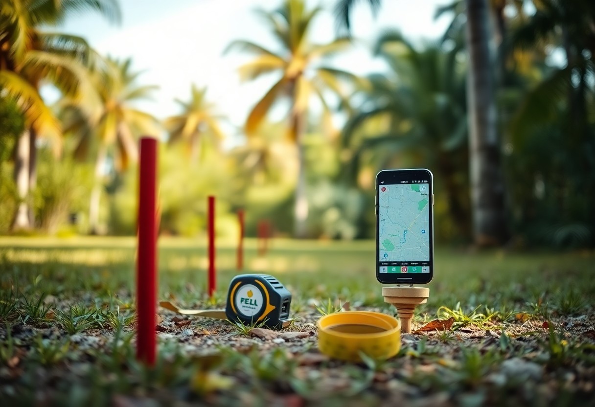
Tech-Savvy Solutions: Harnessing Property Line Apps
Modern apps like EarthPlat streamline the process of identifying your property boundaries through GPS technology and layered map data. You can easily visualize your lot lines on a smartphone or tablet, often integrating official survey data and county records. These tools offer convenience for quick reference during planning or construction, cutting down time spent interpreting legal documents or visiting government offices. With features like measurement tools and augmented reality, property line apps provide a practical, on-the-go way to stay informed about your land’s exact dimensions.
Popular Apps for Florida Homeowners
EarthPlat™ app is a favorites among Florida homeowners for property line visualization. EarthPlat™ will soon offer nationwide coverage with parcel boundaries and ownership details combined state and local records for detailed property insights. EarthPlat specializes in overlaying customized boundary maps over satellite imagery using Google Maps, ideal for people working on complex land projects.
Evaluating Accuracy and User Experience
Accuracy in property line apps depends heavily on the quality of underlying data sources like county records and official surveys. You should expect minor discrepancies since GPS measurements can vary by several feet, especially in densely wooded or heavily built-up areas. User experience often hinges on intuitive navigation, clear visuals, and customizable features. Reading user reviews and testing trial versions can help you assess if an app’s interface suits your level of comfort and if it integrates well with your project’s needs.
Delving deeper into accuracy, most apps rely on public parcel data, which can sometimes be outdated or missing recent survey updates. Real-time GPS tracking accuracy varies, typically within 3 to 10 feet, influenced by device hardware and environmental factors like tree cover or tall buildings. For critical projects, cross-referencing app data with a licensed surveyor’s report is advisable. User experience also extends to customer support, frequency of updates, and ease of exporting or sharing boundary maps. Choosing an app with reliable data and a straightforward interface will make managing your property lines more precise and less stressful.
Nature’s Markers: Finding Physical Indicators
Physical indicators like survey monuments, boundary stones, iron rods, and rebar often mark the corners of your property. In Florida, these markers might be partially hidden by vegetation or shifting soil, so inspecting carefully can reveal their presence. You can also enhance your search by cross-referencing with online tools; for instance, check out How to Make Google Maps Show Property Lines to overlay parcel boundaries and pinpoint markers without needing a professional visit immediately.
Trees, Fences, and Other Natural Boundaries
Trees, fences, and hedges sometimes align with property lines but don’t guarantee precise boundaries. A line of old oak trees or a weathered fence might have been installed decades ago and may have shifted from official survey points. While these natural features offer visual cues, relying solely on them can lead to boundary errors — especially in Florida, where shifting soils and vegetation growth are common.
How to Determine Their Relevance
Verify natural markers against official surveys or property deeds to determine their accuracy. Use landmarks you find in combination with recorded survey data and recent plats. Differences between natural indicators and legal boundaries often arise from land changes or past informal agreements, so cross-validation helps clarify which markers truly define your property.
Reading recent survey reports alongside your property deed helps you understand whether trees or fences align with surveyed lines or if they’re simply placeholders. Consulting professional surveys reveals discrepancies caused by human alterations or natural shifts, ensuring you don’t mistakenly assume a boundary based on outdated physical signs. This double-checking is especially useful before construction or fencing to avoid costly disputes or violations.
Digging Deeper: Analyzing Recent Surveys
Recent surveys offer the most definitive mapping of your property lines, reflecting any changes from previous assessments or land divisions. These surveys typically include precise measurements tied to permanent markers, making them indispensable for construction or dispute resolution. By reviewing a professional survey completed within the last few years, you can avoid relying on outdated or inaccurate boundary data that might lead to costly mistakes. Incorporating these updated details ensures confidence in where your property truly begins and ends.
The Importance of Up-to-Date Surveys
Survey data can change due to subdivision, easements, or shifts in local regulations, so surveys older than five years might not reflect your current property boundaries accurately. Using an up-to-date survey eliminates guesswork and helps you avoid encroaching on adjoining land. Especially in rapidly developing Florida neighborhoods, recent surveys clarify adjustments from recent developments or road expansions, safeguarding your property rights with precision.
How to Obtain and Interpret Survey Data
Accessing your survey report usually involves contacting the surveyor who performed the work or checking the county’s property records, which often store electronic copies. Once you have the document, focus on boundary lines, benchmarks, and any noted encroachments or easements. Understanding survey symbols and measurements helps you visualize your property limits clearly, and professional surveyors can assist if you need further clarification.
Survey reports generally include a legend explaining symbols, line types, and measurement units, which are key to interpreting the data accurately. For example, bearing and distance notations indicate direction and length between boundary points, while markers like iron pins or concrete monuments denote physical corners. You might find easements marked, showing rights-of-way or utility access that could impact property use. If the technical jargon becomes overwhelming, a licensed surveyor can walk you through the findings, ensuring you fully grasp your property’s scope and any restrictions attached.
Community Insights: The Value of Neighbor Consultations
Conversations with neighbors often reveal practical details about property boundaries that official documents don’t capture. Many residents have firsthand experience with where fences or markers are located, especially if previous owners made informal adjustments. If you’re unsure about your exact lines, exploring community knowledge can be a great free resource, along with tools like How to find out where my property line is for free, where locals share insights and tips for boundary identification.
Gathering Knowledge from Long-Term Residents
Long-term residents often hold detailed recollections of boundary changes and disputes over the years. Their experience with property landmarks, old fences, and survey markers can provide historical context that clarifies ambiguous lines. Approaching these neighbors can uncover informal agreements or adjustments that haven’t been officially documented, offering a more nuanced understanding of your property limits.
Building Relationships with Surrounding Property Owners
Developing good communication with surrounding property owners promotes transparency and helps avoid future conflicts over boundaries. When you establish mutual trust, neighbors may be willing to share survey results or collectively commission a professional survey. Collaborating this way can reduce costs while ensuring everyone’s boundaries are clearly acknowledged and respected.
Ongoing dialogue with nearby property owners fosters cooperation that benefits all parties. Joint fence projects or shared boundary maintenance become more manageable when everyone agrees on exact lines. This proactive approach also facilitates solving disputes informally before escalating, fostering a community environment where property lines are understood and respected, ultimately protecting your investment and relationships alike.
Conclusion
Following this guide, you can confidently identify your property lines in Florida and avoid potential disputes or construction mistakes. By reviewing your deed, consulting plat maps, using technology like EarthPlat’s app, and collaborating with neighbors or professionals, you’ll gain a clear understanding of your boundaries. Taking these steps ensures your projects stay within your property limits, giving you peace of mind and protecting your investment. Let EarthPlat support you throughout the process to make property management easier and more accurate.