
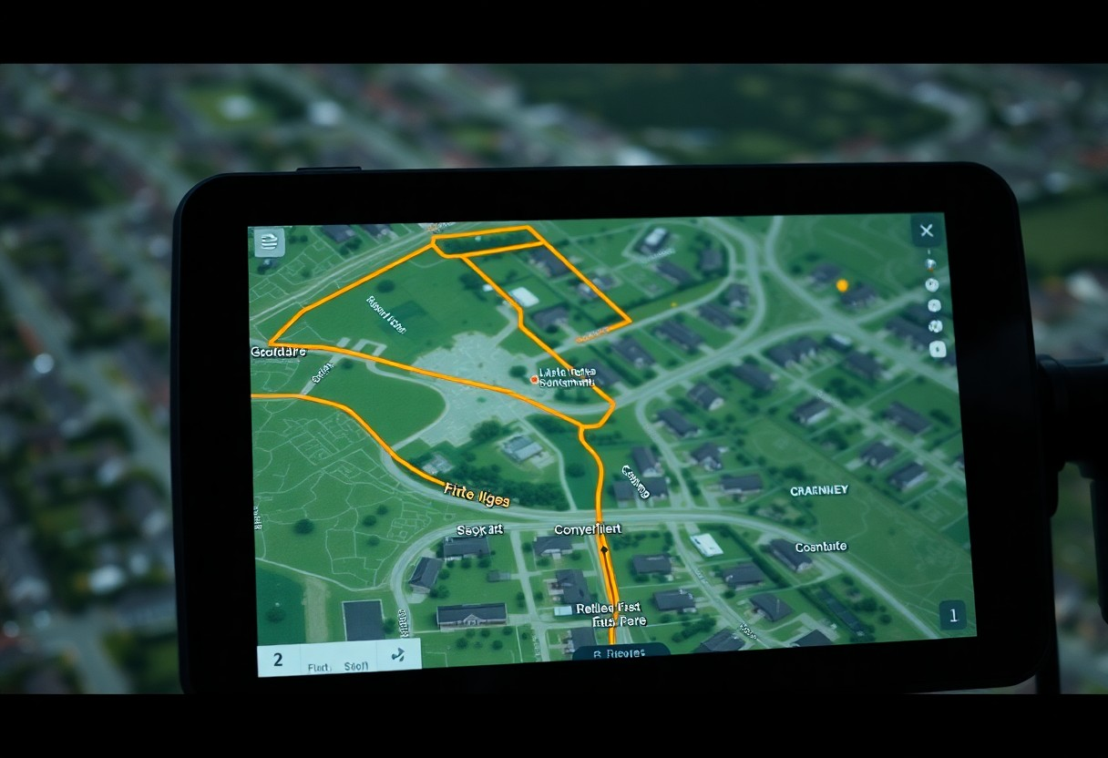
It’s vital to understand how accurately a coordinates finder can display parcel boundaries and property lines. As a property owner or prospective buyer, knowing these boundaries can impact your decisions significantly. This technology often utilizes GPS data and mapping software to provide insights into property limits, but its precision can vary. In this post, you’ll explore the effectiveness of these tools, the factors influencing their accuracy, and how to interpret the information they provide for your property needs.
The Technology Behind Coordinates Finding
Understanding the technology that powers coordinates finding is vital for accurate parcel boundary and property line representation. Advances in satellite technology and software applications are central to this evolution, enabling precise mapping that benefits various sectors, including real estate, agriculture, and utilities. With the integration of real-time data, these technologies allow for a seamless experience in identifying and navigating property boundaries, mitigating the risks of inaccuracies.
GPS and Its Role in Precision Mapping
GPS technology serves as the backbone of precision mapping, providing pinpoint accuracy through a network of satellites orbiting the Earth. By triangulating signals from these satellites, you can determine your location within a few centimeters. This level of accuracy is important for tasks requiring detailed mapping, such as defining property lines or managing land use, ensuring you have reliable data for your projects.
Innovations in Geospatial Data Collection
Recent innovations in geospatial data collection have revolutionized how you gather and analyze geographic information. Technologies like drones and LiDAR (Light Detection and Ranging) are now standard tools in capturing complex land features and boundaries. These innovations enhance the efficiency and precision of data collection processes, making it easier for you to access reliable information for your needs.
Drones equipped with high-resolution cameras and sensors allow for aerial mapping of large areas, capturing detailed imagery and topographical data rapidly. LiDAR, on the other hand, uses laser pulses to create precise 3D models of terrain and structures, ensuring you can identify even subtle changes in elevation or boundary lines. With these tools, property surveys are faster, and the likelihood of human error decreases significantly, further solidifying the reliability of property and parcel boundary delineations.
The Accuracy Debate: Are Parcel Boundaries Truly Represented?
Accuracy in displaying parcel boundaries largely hinges on the precision of the data source. Even with advanced technology, discrepancies can arise between coordinates finder data and actual property lines, leading to questions regarding their reliability. Real-life cases often show that digitized boundaries may not align perfectly with physical markers, emphasizing the need for careful verification against official records for definitive clarity.
Comparing Coordinates Finder Data with Official Records
Understanding the differences between coordinates finder data and official records is necessary to assess accuracy. A table summarizing these comparisons highlights key distinctions:
| Coordinates Finder Data | Tends to be approximate, influenced by mapping software algorithms. |
| Official Records | Typically derived from surveys conducted by licensed professionals, ensuring higher accuracy. |
Factors That Complicate Boundary Accuracy
Multiple factors contribute to the complexities surrounding boundary accuracy. Changes in land usage, local regulations, and unrecorded property alterations can affect the alignment of surveyed lines against current data. Additionally, older properties may have boundaries derived from outdated surveys, making it necessary to consult recent developments for an accurate representation.
- Changes in land ownership can lead to boundary disputes.
- Natural changes, such as erosion, can alter physical markers.
- Inconsistent surveying technology may yield varying results.
- Perceiving accuracy relies on updating and verifying property information periodically.
Regular updates and accurate mapping play a critical role in minimizing these issues. Variations in measurement practices, lack of standardization across jurisdictions, and misinterpretation of data can all lead to compounded inaccuracies. You should consider engaging professional surveyors for precise delineations. Addressing these factors reduces misunderstandings that can arise over property lines.
- Varying state laws can influence boundary interpretations.
- Inaccurate GPS data may misposition parcel edges.
- Historical records may not reflect current legal descriptions.
- Perceiving the environment surrounding a property can alter your understanding of boundaries.
Real-World Applications and Limitations
In practical use, coordinates finders play a significant role in real estate, land surveying, and construction, enabling users to identify and mark property boundaries accurately. However, their effectiveness can be limited by factors such as data quality, mapping software discrepancies, and the complexity of local land regulations. While coordinates finders are a valuable tool, you must recognize their limitations to avoid potential legal and financial complications.
How Surveyors Use Coordinates Finders in Practice
Surveyors utilize coordinates finders to delineate parcel boundaries with precision, relying on GPS technology for accurate readings. By inputting specific geospatial data, they can create detailed property surveys, identify easements, and resolve boundary disputes. This method enhances your understanding of property dimensions, offering a reliable reference during transactions and land development projects.
Scenarios Where Coordinates May Mislead
Coordinates may mislead in several scenarios, including outdated information, variations in measurement standards, and physical obstructions. For instance, a parcel boundary indicated by coordinates might conflict with recent developments or natural changes in the landscape, leading to misunderstandings. Additionally, discrepancies in local jurisdiction surveys can complicate interpretations of property lines.
Outdated information remains a primary issue; coordinates derived from old surveys can misrepresent current boundaries, resulting in legal disputes. Variations in measurement standards may arise when different survey methods are applied, leading to differing representations of the same property. Physical obstructions, such as fences or trees, can also create misconceptions about boundary lines, as they may not accurately reflect the legal dimensions recorded in official documents. This emphasizes the need for cross-referencing coordinate data with legal property documents for reliable outcomes.
Navigating Property Lines: Tools and Best Practices
Utilizing effective tools and adhering to best practices can enhance your understanding of property lines and boundaries. Digital mapping software, GPS technology, and professional land surveys provide important data for accurately navigating these spaces. By combining technology with a solid grasp of local regulations and property laws, you can ensure your assessment of boundaries is both informed and precise.
Choosing the Right Coordinates Finder for Your Needs
Selecting the appropriate coordinates finder is key to accurately mapping your property lines. Consider factors like data accuracy, ease of use, and integration with other mapping tools. Look for platforms that offer detailed topographic maps and GIS data relevant to your location, as these features will significantly enhance your property boundary assessments.
Tips for Verifying Property Boundaries
Verifying property boundaries involves multiple steps that solidify your understanding of where your land starts and ends. Begin by reviewing property deeds and legal descriptions, then compare them with GPS data or coordinates finders. Conducting a physical inspection of the land, including any markers or fencing, is necessary for confirmation.
- Check public records for accurate descriptions of your property.
- Utilize technology like GPS and GIS for precise location mapping.
- Engage with professional surveyors when in doubt.
- This will provide additional assurance of your boundaries.
Consider reaching out to neighboring landowners to gather information regarding longstanding boundary agreements or disputes. Having open communication can lead to clarity and potentially prevent future conflicts over property lines. Observing any existing boundary markers and comparing those to digital tools can also reveal discrepancies that need addressing.
- Document findings during your verification process for reference.
- Engage with local land records offices for updated information.
- This ensures you have a comprehensive view of your property lines.
The Future of Parcel Boundary Mapping
Emerging Technologies and Their Potential Impact
Advancements in technologies like drone surveying, satellite imagery, and AI-driven analytics are revolutionizing parcel boundary mapping. These innovations provide enhanced precision and efficiency, allowing for real-time updates and detailed assessments. You can expect significantly reduced costs and improved access to accurate boundary data, enabling clearer property delineation and better decision-making in land management.
Regulatory Changes Shaping the Industry
Shifts in regulations can significantly influence how you access and utilize parcel boundary data. New laws promoting transparency and accessibility may lead to more standardized mapping practices across jurisdictions, ensuring that you receive consistent and reliable information. These changes often introduce tighter data privacy standards, impacting how property lines are surveyed and reported.
Recent regulatory changes have focused on enhancing digital mapping standards to improve accuracy and accessibility. For instance, the implementation of the Geospatial Data Act requires federal agencies to adopt new guidelines for data sharing, which will trickle down to local levels. This creates an environment where you benefit from more reliable and standardized boundary information, minimizing disputes and confusion over property lines. As regulations evolve, they can encourage innovation and collaboration among industry stakeholders, further enhancing the overall effectiveness of parcel boundary mapping solutions.
Summing Up
So, you can confidently rely on a coordinates finder to accurately display parcel boundaries and property lines, as these tools utilize precise geographical data and advanced mapping technologies. By leveraging such tools, you gain a clear understanding of your property boundaries, which can assist in making informed decisions regarding land use and planning. However, it is always wise to corroborate the information with official surveys for the most reliable results.